Explore Top Aviator GPS Devices for Precision Navigation
Accuracy is an absolute must for pilots, and aviator GPS devices provide the precision navigation that’s necessary.
The range of Garmin aviation GPS systems we sell all provide precise navigational data, terrain and obstruction mapping, weather tracking, air traffic and airport conditions, and other essential navigational information that pilots need to safely fly the skies.
Common features of the aviation GPS devices, such as the Garmin aera 760, include:
- Direct-to navigation that allows you to set a waypoint and receive corresponding guidance for the best flight path while accounting for air traffic both in-air and at destination airports.
- Map topography to help you understand where you are relative to sea level and land masses.
- 3D maps to help you see the terrain below your plane or helicopter.
- Wire, terrain, and building detection to ensure you’re safe from higher-set ground hazards.
- Weather and wind conditions from your point of departure, along the flight path, and at your destination airport or runway/helipad.
- Dynamic maps that update as conditions change.
- Airport information, including safe areas to taxi your plane when not in the air.
- Fuel price information to help you budget and plan flights.
These are just some of the features you can typically expect from high-end aviation GPS units.
Portable Aviation GPS Solutions for On-the-Go Pilots
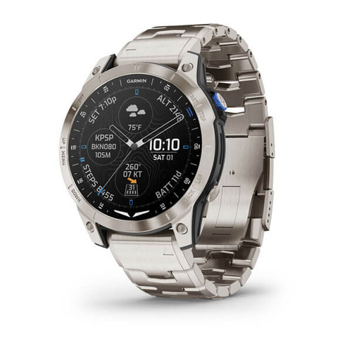
If you’re a pilot who likes to keep moving even when your feet are on the ground, then you’ll love portable aviation GPS devices such as Garmin’s aviator smartwatch, the D2 Mach 1 Pro.
These smartwatches include similar navigation features and dynamic maps for when you’re flying, along with smartwatch features that allow you to monitor your health, heart rate, and ground-based navigation. You can also take calls through the watch and send messages through voice activation - ideal if you need to keep your eyes on the sky in front of you.
Why Choose Aviation GPS Portable Devices for Your Cockpit
Portable aviation GPS units are a great option for all pilots, from amateur to seasoned veterans. Having a portable GPS in addition to a plane’s on-board avionics is a worthwhile investment as it gives you additional sets of data to refer to so you can make the right navigational decisions as you’re in the air.
These portable aviator GPS devices are an absolute must for any pilot who flies a smaller helicopter or plane that may not have advanced avionics built in. You can also improve GPS functionality through devices such as the Garmin GDL® 50 Portable ADS-B Receiver, which can work in unison with a Garmin aviation GPS to improve location tracking, weather info, and other relevant navigation data.
FAQs for Aviation GPS
As we touched on, aviation GPS is all about making flying easier for pilots. The key features you’ll often come across with aviator GPS devices include:
- Direction and navigation: shows the pilot where they’re currently flying and the route they need to take to reach their destination.
- Altitude and attitude: information regarding how high the plane is above sea level and the orientation at which they’re flying.
- Airspace boundaries and terrain alerts: ensures pilots avoid areas with airspace restrictions and provides warnings if there’s any upcoming terrain in their way (e.g. an approaching mountain range).
- Weather: the current weather conditions in their current location, as well as the weather conditions of their destination.
Regular GPS units are primarily designed for the most common forms of travel people use - driving, cycling, walking, etc. Their functionalities often overlap and are mostly focused on simply helping you get from A to B or discover nearby points of interest (such as with an app like Google Maps).
Aviator GPS, on the other hand, is designed specifically for those involved in aviation. As such, their features are focused on what pilots need. This can include many of the features we covered in the previous question, such as airspace boundaries, weather information from point of departure to point of arrival, air traffic information, altitude and attitude/orientation.
Navigation is completely different, as well, focused on providing the best flight path possible while accounting for the current level of air traffic along that path.
For any pilot, whether they’re still in training or have decades of experience under their belt, the benefits of aviation GPS systems are clear and plentiful.
Simply put, if a pilot wants to safely navigate the skies, adapt to changing weather conditions, move effectively with the flow of air traffic, and get to their destinations with minimal issues, then aviation GPS is essential.
Real-time GPS units are the best option for modern pilots and make the job of navigating the skies a more manageable and intuitive affair.


